History, beside
the road.
Ancient landscapes. Revolutionary conflict. A company town. Everyday buildings and places of remembrance. Follow the markers — then read the stories they cannot fit on a sign.
Narrows Dam · Wasrts / Wikimedia Commons · CC BY-SA 4.0
Coverage reviewed October 15, 2026: every entry in the supplied HMdb county list, cross-checked against the six DNCR state-marker records, plus two additional sites named by the City of Albemarle. This is a documented directory, not a claim that every unlisted plaque, cemetery memorial or newly installed sign in the county has been inventoried.
Plan a history day.
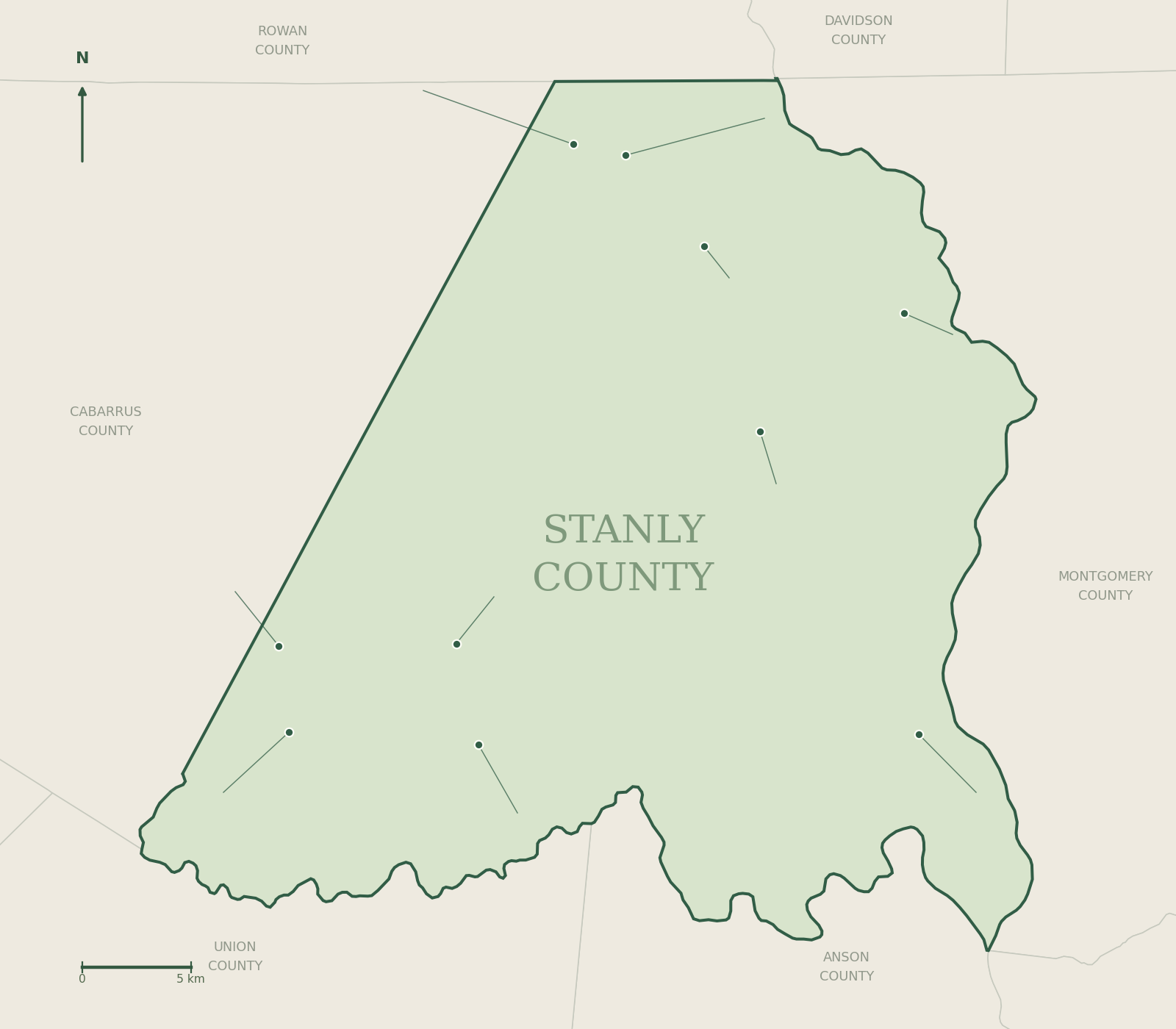
The county view shows the six state signs and the dense Albemarle cluster. The downtown view expands all 15 Albemarle records, grouping signs that share a small area. Pin numbers match the directory table; expand a numbered group or choose a pin for its companion history page and exact street-map link.
County overview
These coordinate plots preserve north/south and east/west positions within each panel. They do not show roads, walking routes, property boundaries or access entrances. Grouped points use the mean published location; each group opens links to its individual records. All 22 records also have separate direction links in the table.
The silver-and-black starting points.
Each links to the current North Carolina historical essay, its published roadside location and a fuller local guide.

Hardaway Site — L-97
A roadside introduction to a landmark in American archaeology.
Read the full history →
L’Aluminium Français — L-95
French industrial ambition at the Narrows of the Yadkin.
Read the full history →
Pfeiffer University — L-73
From a small mission school to a university in northern Stanly.
Read the full history →
Fight at Colson’s — L-51
A small 1780 battle, and a correction to the marker’s familiar wording.
Read the full history →
Randall’s United Methodist Church — L-83
A congregation remembered through homes, itinerant preaching and successive buildings.
Read the full history →
Barringer Mine — L-98
The discovery that moved North Carolina gold mining into the rock.
Read the full history →Albemarle: civic life & public memory.

A Shard from the Pentagon
A fragment of a national tragedy, preserved in a local garden.
Read the full history →Alameda Theatre
The arrival of purpose-built cinema on North Second Street.
Read the full history →Albemarle Hotel
Sixty rooms and a new setting for the town’s social life.
Read the full history →
Charters of Freedom
A local place to encounter the nation’s founding documents.
Read the full history →Courthouse Square Park
A park laid over the changing center of county government.
Read the full history →
Freeman-Marks House
A small house whose repeated moves followed a growing town.
Read the full history →Home Builders Association
A banking history preserved beside a downtown entrance.
Read the full history →
In Grateful Remembrance — WWII, Korea & Vietnam
A courthouse memorial to sacrifice and service in three conflicts.
Read the full history →In Grateful Remembrance — World War I
A 1928 dedication remembering Stanly County’s World War service.
Read the full history →Isaiah & Ellen Snuggs House
A modest early dwelling expanded into a prominent family home.
Read the full history →Liberty Gardens Veterans Memorial
A sequence of military conflicts in a downtown memorial garden.
Read the full history →Stanly County Confederate Monument
A 1925 monument that is also evidence of later public memory.
Read the full history →Stanly County Courthouse
A modern courthouse on a site with a much older commercial story.
Read the full history →Stanly County Library
A library whose earlier homes trace the town’s civic geography.
Read the full history →Starnes-Parker Building / Opera House
Shops below, entertainment above, and an unexpected later use.
Read the full history →Badin: the town beyond the state signs.

North and south: follow the state-marker trail.
Pfeiffer University — L-73
From a small mission school to a university in northern Stanly.
Read the full history →Fight at Colson’s — L-51
A small 1780 battle, and a correction to the marker’s familiar wording.
Read the full history →Randall’s United Methodist Church — L-83
A congregation remembered through homes, itinerant preaching and successive buildings.
Read the full history →Barringer Mine — L-98
The discovery that moved North Carolina gold mining into the rock.
Read the full history →Two more sites in the city’s program.
The City of Albemarle’s ten-stop marker announcement also names these sites. They are not in the supplied HMdb set. Their companion pages explain the history and the limits of the installation evidence, so they are excluded from the 22-record charts and maps.
The directory in numbers.
Documented entries by place
How the 22 entries are classified
The six state signs are included in the 17 HMdb historical-marker entries. Five additional records are classified as war memorials. 17 + 5 = 22. This avoids counting the six state records twice. Place counts follow the HMdb locality labels; “Norwood” includes nearby unincorporated locations.
Counts are a calculation from the 22 supplied HMdb entries, checked against their individual records. The two separately identified city-program sites are excluded. A marker’s casting year, installation year, photograph date and the date of the event it commemorates are different fields.