Stanly County Outdoors: Hiking, Lakes & Parks
Plan hiking, paddling, camping, off-road riding and park visits in Stanly County and the nearby Uwharrie region.
Pictured: the view from Morrow Mountain State Park. Photo: DiscoA340 / Wikimedia Commons, CC BY-SA 4.0
Choose your next outdoor stop
Photo links, official trail maps and directions in one place. Nearby Uwharrie campgrounds are identified separately from Stanly County destinations.

Morrow Mountain State Park
Wooded trails, the mountain overlook, camping and Yadkin River access. Check park alerts and facility hours.
49104 Morrow Mountain Road, Albemarle, NC
Photo: DiscoA340 / Wikimedia Commons · CC BY-SA 4.0

Falcon Trail
A local trail connection in the Misenheimer–Richfield area. Use the trail manager’s map for access and current notices.
Misenheimer / Richfield, NC
Image / preview: carolinathreadtrailmap.org

Rock Hole Creek Trail
Explore a wooded Stanfield trail. The official trail page provides the route and access information.
Stanfield, NC
Image / preview: carolinathreadtrailmap.org

Dirt Bikes & ATVs
The Uwharrie’s Badin Lake OHV trails, nearby motocross tracks, trail passes, a riding map and North Carolina ATV rules.
Badin Lake OHV Trail Complex, Montgomery County (nearby)
Representative photo: U.S. Forest Service · public domain

Badin Lake Campground
A nearby Uwharrie National Forest camping option across the lake in Montgomery County. Check reservations and operating dates.
Badin Lake Recreation Area, Montgomery County, NC
Image / preview: recreation.gov

Canebrake Horse Camp
A nearby national forest equestrian camping base in Montgomery County. Review horse-camp rules and current availability.
Uwharrie National Forest, Montgomery County, NC
Image / preview: recreation.gov
Morrow Mountain photograph: DiscoA340 / Wikimedia Commons · CC BY-SA 4.0. Other images and website previews link to their official source pages. Checked October 22, 2026.
Trails & campgrounds.
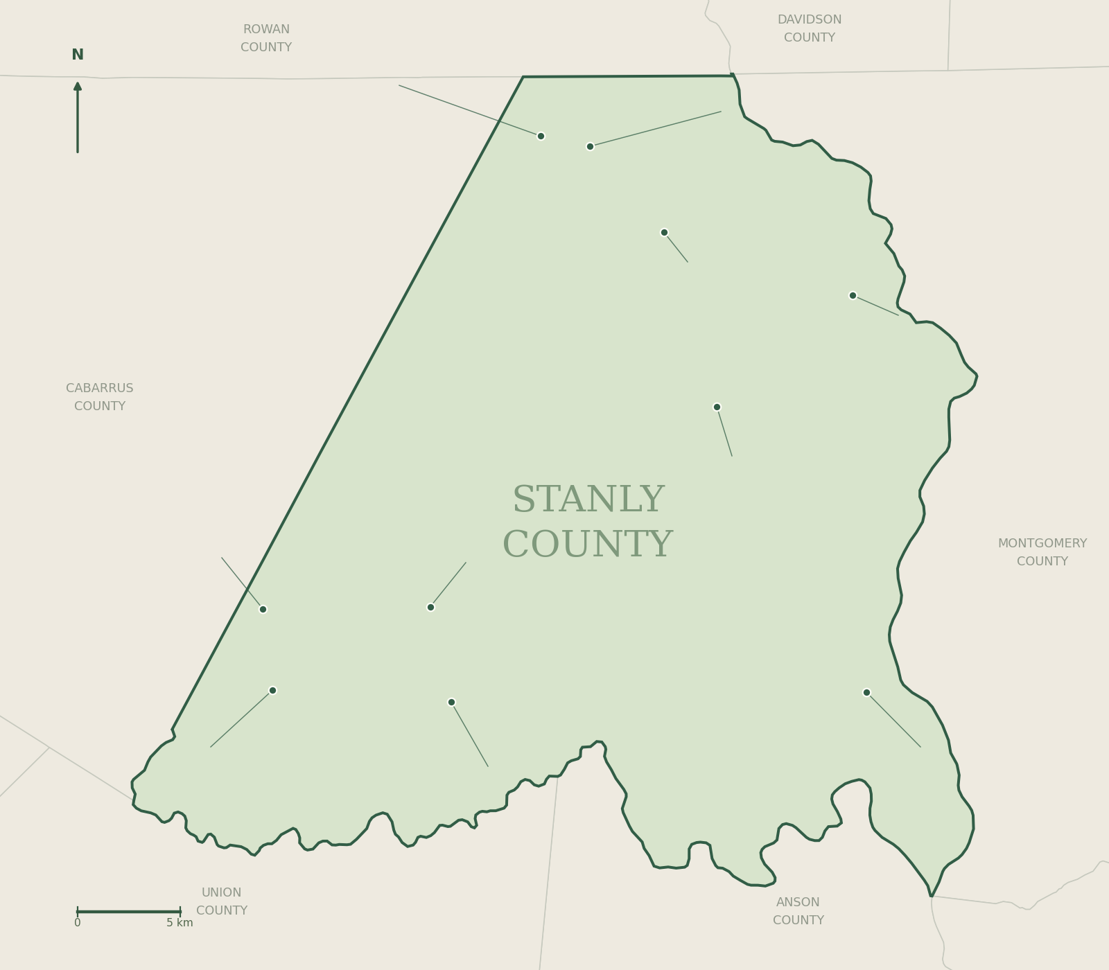
Select a numbered label to open the related guide. The list below gives the verified street address or published access location, latitude, longitude and coordinate source.

Badin Lake Campground
Address / access: 429 Badin Lake Rec Area Road, Troy, NC 27371
Latitude: 35.4484722
Longitude: -80.0786611
Canebrake Horse Camp
Address / access: 616 McLeans Creek Road, Troy, NC 27371
Latitude: 35.4394444
Longitude: -80.0486111
Falcon Trail — trailhead 1
Address / access: Richfield Park Road and NC 49, Richfield, NC 28137 (published park access address; individual marker has no separate street number)
Latitude: 35.4775488736828
Longitude: -80.2638379523277
Falcon Trail — trailhead 2
Address / access: Richfield Park Road and NC 49, Richfield, NC 28137 (published park access address; individual marker has no separate street number)
Latitude: 35.4774242364368
Longitude: -80.261259765052
Rock Hole Creek Trail — trailhead 1
Address / access: Park Drive, Stanfield, NC 28163
Latitude: 35.2297986378821
Longitude: -80.4288708030981
Before you head out
Check the managing agency’s current alerts, weather, water levels and reservation rules. Map points identify published access references; they do not show trail routes or guarantee parking, public access or open facilities.