Historic places & landmarks
Seventeen National Register listings, a National Historic Landmark 10,000 years deep, a French-planned company town, and the roadside markers that tell the stories in a sentence.
Photo: Jerrye & Roy Klotz, MD / Wikimedia Commons, CC BY-SA 3.0
Follow the signs. Find the stories.
Explore all 22 documented county markers and memorials, plus two additional sites in Albemarle’s marker program. Every entry has its own history, photographs or a documented setting image, source links, milestones and directions.
Overview
Listings by town
National Register entries
Source: National Register listings in Stanly County (Wikipedia list of NPS data).
Listings by decade added
Year placed on the Register
Computed from listing dates in the table below.
All National Register listings
Sorted by date listed. Most are private property: view from public streets and respect owners.
| Name | Town | Listed | Address / location | What it is |
|---|---|---|---|---|
| Badin Historic District | Badin | Oct. 12, 1983 | Roughly bounded by NC 740, Pine St. and the country club | Company town begun c. 1912; 170 acres, 200 contributing buildings; Gothic Revival and Craftsman designs |
| Narrows Dam and Power Plant Complex | Badin | Oct. 12, 1983 | Yadkin River at SR 1704 | 1917 concrete dam and powerhouse; world’s highest overflow dam when completed |
| West Badin Historic District | Badin | Oct. 12, 1983 | Roughly Sims, Lincoln, Marion and Lee Sts. | Section of Badin built for African American workers from c. 1912; 84 acres, 153 contributing buildings |
| Hardaway Site (31ST4) | Badin | Mar. 1, 1984 | Ridge above Badin Lake, west of the dam | Archaeological site with occupation layers back about 10,000 years; National Historic Landmark 1990 |
| Randle House | Norwood | Sept. 8, 1992 | SR 1802 at SR 1743 | c. 1835 Federal/Greek Revival plantation house on about 14 acres |
| Opera House–Starnes Jewelers Building | Albemarle | Mar. 9, 1995 | 127–133 W. Main St. | 1907–1908 brick building with an upstairs opera house; Art Moderne storefronts of 1939 |
| Isaiah Wilson Snuggs House | Albemarle | Mar. 9, 1995 | 112 N. Third St. | Two of the city’s oldest houses, run as house museums by the Stanly County Museum |
| Pee Dee Avenue Historic District | Albemarle | Jan. 7, 1998 | Pee Dee Ave. from about Arey Ave. to Miller St. | Residential street, c. 1891–1947; 48 acres, 87 contributing buildings |
| Pfeiffer Junior College Historic District | Misenheimer | Apr. 28, 1999 | US 52, 1 mile north of NC 49 | Historic core of the Pfeiffer campus |
| Downtown Albemarle Historic District | Albemarle | Mar. 28, 2002 | Parts of S. 2nd, W. Main and N./S. 1st Sts. | Commercial core, c. 1898–1950; 20 contributing buildings including the 1927 Fitzgerald Building |
| Five Points Historic District | Albemarle | Oct. 16, 2002 | E. Main St., Pee Dee Ave. and 4th St. | Six commercial and industrial buildings, c. 1905–1950, including Lillian Knitting Mills |
| Second Street Historic District | Albemarle | Apr. 6, 2005 | 100–200 blocks N. Second St.; 100 block W. North St. | Civic and church blocks, c. 1898–1950: Alameda Theater (1916), Albemarle Hotel (1923), City Hall (1938), former post office (1936) |
| Thomas Marcellus Denning House | Albemarle | Jan. 24, 2011 | 415 N. Second St. | c. 1924–1925 Spanish Colonial Revival house by architect Louis H. Asbury |
| Albemarle Graded School–Central Elementary School | Albemarle | Dec. 2, 2014 | 219 E. North St. | Historic graded-school building, still in use as Central Elementary |
| Richfield Milling Company | Richfield | Sept. 19, 2016 | 303 S. Main St. | c. 1920 heavy-timber roller mill beside the railroad; the town’s last historic industrial building |
| Julius Clegg Hall House and Grounds | Albemarle | Apr. 22, 2021 | 343 N. Second St. | House NCpedia dates to 1912, with its grounds |
| Gladstone Academy | Misenheimer | Apr. 10, 2025 | 48210 Wesley Chapel Rd. | c. 1894 school building, significant in education; used as a church from 1910 |
Sources: Wikipedia, National Register of Historic Places listings in Stanly County (NPS data), and individual property articles; NC DNCR (Gladstone Academy, 2025); Salisbury Post (Richfield Milling, 2016); NCpedia (Hall House). Nomination files are at the NC State Historic Preservation Office.
Hardaway Site (National Historic Landmark)
On two knolls and a saddle at the end of a rocky ridge above Badin Lake, people camped and made stone tools for roughly 10,000 years. Four layers of artifacts, each with stone-lined hearths and heavy scatters of flaking debris, sit above sterile clay. An amateur archaeologist identified the site in 1937; the University of North Carolina began professional excavations in 1948 with the landowner’s permission and continued systematic work until 1958. A 1964 analysis of the finds built a typology and chronology of early stone points that archaeologists still use to date other sites in the eastern United States. By 1980 more than seven metric tons of material had been recovered, and in 2005 Alcoa donated more than 1.3 million artifacts to UNC. The site was listed on the National Register in 1984 and designated a National Historic Landmark on June 21, 1990. It is not open to the public; state highway marker L-97 tells its story.
Badin’s historic districts and dam

Photo: Nyttend / Wikimedia Commons, Public domain
A French plan, finished by Alcoa
Southern Aluminum Company began the town in 1912–1913, with New York architects giving it a European character, including quadruplex apartments for French workers. Alcoa completed it after 1915. The 170-acre district counts 200 contributing buildings and eight sites, among them the Badin Club House (c. 1914), the 1913–1914 quadruplexes on Boyden Street, the hospital and school (c. 1920) and Badin Baptist Church.

Photo: Wasrts / Wikimedia Commons, CC BY-SA 4.0
An engineering record-setter
Built where the Yadkin squeezes to under 100 feet wide through an Uwharrie gorge, the 1917 concrete dam was the world’s highest overflow-type dam when finished. (Sources give its height as 185 or 216 feet.) The listed complex covers 72 acres: the dam, the nine-bay powerhouse with its raised monitor roof, and related structures. An earlier attempt by George Whitney to dam the Narrows, begun around 1899, had failed.
West Badin Historic District preserves the 84-acre neighborhood developed for Badin’s African American workers, with 153 contributing buildings, including McDonald’s Chapel AME Zion Church, a Baptist church and the Badin Colored School. Lou Donaldson, the jazz saxophonist, was born in Badin in 1926. See community histories.
Albemarle’s districts and houses
 NRHP 1995
Snuggs House
The Isaiah Wilson Snuggs House is the city’s second-oldest house. The NRHP record dates it to about 1874; the local marker says it may have been built by John Ross in the early 1850s, served as a law office, and was sold to Isaiah Snuggs in 1873.
Museums →Photo: Jerrye & Roy Klotz, MD / Wikimedia Commons, CC BY-SA 3.0
 c. 1847
Freeman–Marks House
Built by Daniel Freeman and moved into town around 1847, this Federal–Greek Revival frame house is Albemarle’s oldest surviving dwelling. It was moved again in 1975 to its present site behind the Snuggs House, and both were restored in the 1980s.
Museums →Photo: Jerrye & Roy Klotz, MD / Wikimedia Commons, CC BY-SA 3.0
| District | Era | Size | Highlights |
|---|---|---|---|
| Downtown Albemarle | c. 1898–1950 | 5 acres, 20 buildings | King Block and J. C. Parker Building (1898), Efird Dry Goods (1903), Fitzgerald Building (1927), Morgan Furniture (1924), Central Lunch (1929–30) |
| Second Street | c. 1898–1950 | 9.5 acres, 12 buildings | Central Methodist (1908), First Baptist (1919), First Presbyterian (1924), Alameda Theater (1916), Albemarle Hotel (1923), City Hall (1938) |
| Pee Dee Avenue | c. 1891–1947 | 48 acres, 87 buildings | Brown–Parker House (c. 1891), Crowell House (c. 1900); Queen Anne, Colonial Revival and Craftsman homes |
| Five Points | c. 1905–1950 | 3.4 acres, 6 buildings | Lillian Knitting Mills (1905), Morgan Motor Co. (1922), Model Tailoring Co. (1922), Anderson Grocery (c. 1928) |
The Albemarle Hotel (1923) opened with 60 rooms, a ballroom and a dining room and has been converted to apartments. The Opera House–Starnes Jewelers Building housed the Albemarle Opera House upstairs and retail below; its storefront was restored in 1990. The Denning House (c. 1924–25) is a two-story brick Spanish Colonial Revival design by architect Louis H. Asbury, with tiled pent cornices and a porte cochere.
Norwood, Richfield and Misenheimer

Photo: Schlachtenbummler / Wikimedia Commons, CC BY-SA 3.0
Pfeiffer campus and Gladstone Academy
The Pfeiffer Junior College Historic District (1999) protects the historic core of the campus along US 52. Nearby, Gladstone Academy, built around 1894 and used as a school until it became a church in 1910, joined the Register in April 2025, the county’s newest listing.
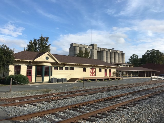
Near Norwood, the Randle House (c. 1835) is a two-story frame I-house with a kitchen and dining wing on about 14 acres. The Randle name also figures in Methodist history: state marker L-83 records that Jesse Lee and Bishop Francis Asbury held services around 1785 in John Randle’s home, the start of Randall’s United Methodist Church. In Richfield, the Richfield Milling Company roller mill (c. 1920) stands beside the tracks where farmers once shipped grain.
State highway historical markers
Markers of the North Carolina Highway Historical Marker Program (district L) in Stanly County.
| Marker | Title | Town | What it commemorates |
|---|---|---|---|
| L-51 | Fight at Colson’s | Norwood | July 1780: Col. William Lee Davidson’s Whig militia defeated Col. Samuel Bryan’s Tories a few miles southeast |
| L-73 | Pfeiffer University | Misenheimer | Methodist school founded near Lenoir in 1885 as Oberlin Home & School; here since 1910; renamed for the Pfeiffer family in 1935 |
| L-83 | Randall’s United Methodist Church | Norwood | Services begun c. 1785 by Jesse Lee and Bishop Asbury in John Randle’s home; fifth building dates to 1974 |
| L-95 | L’Aluminium Français | Badin | French company began the Narrows Dam in 1913; town named for Adrien Badin (marker erected 1995) |
| L-97 | Hardaway Site | Badin | Archaeological site occupied from about 10,000 B.C. |
| L-98 | Barringer Mine | Richfield (NC 49 at US 52) | 1825 gold discovery that launched the state’s subsurface gold mining; mine site 2 miles west |
Sources: NC Department of Natural and Cultural Resources marker essays; Historical Marker Database (HMdb). Additional markers may exist; the official list is at ncmarkers.com.
Local markers and memorials
| Marker or memorial | Town | Summary |
|---|---|---|
| Courthouse Square Park | Albemarle | Jail, whipping post and stocks stood on this corner by 1843; second courthouse built here in 1893 |
| Stanly County Courthouse | Albemarle | Site of the Freeman Hotel, 1847–1899 |
| Albemarle Hotel | Albemarle | Completed 1923 with 60 rooms; owner W. C. Fitzgerald |
| Alameda Theatre | Albemarle | Site earlier home to merchant John Odom and Mary Kirk Ross |
| Starnes–Parker Building / Opera House | Albemarle | Completed 1908, retail below and opera house above |
| Home Builders Association | Albemarle | Savings institution on this site from 1911 |
| Stanly County Library | Albemarle | First public library 1916; present building dedicated 1972 on former jail sites |
| Freeman–Marks House; Isaiah & Ellen Snuggs House | Albemarle | House-museum markers |
| The Town of Badin | Badin | Erected by Eagle Creek Renewable Energy; town and dam in hydroelectric and planning history |
| World War I memorial; World War II, Korea and Vietnam memorial | Albemarle | Honor county residents who served and died |
| Liberty Gardens Veterans Memorial | Albemarle | Lists conflicts from the Revolution through the Gulf wars |
| A Shard from the Pentagon | Albemarle | Fragment of the Pentagon wall from the September 11, 2001 attack |
| Stanly County Confederate Monument | Albemarle | Monument to Confederate soldiers, 1861–1865 |
Source: Historical Marker Database, Stanly County listings (22 entries as of October 2026).
Museums and other landmarks
The Stanly County Museum (now based in the History Center at 157 N. Second St.) runs the Snuggs and Freeman–Marks house museums. Morrow Mountain State Park preserves Civilian Conservation Corps–era structures built 1937–1942 and the reconstructed home of Dr. Francis Kron, a Prussian-born physician who bought the property in 1839. NCpedia also lists the Albemarle Town Cemetery (1844), the 1912 Hall House and the 1922 “City of Albemarle” antique fire engine among the county’s historic attractions, and Albemarle’s restored Market Street depot now hosts a farmers’ market.