Stanly County facts & figures
The essential numbers: when and why the county was created, how big it is, who lives here, and how that has changed across 18 censuses.
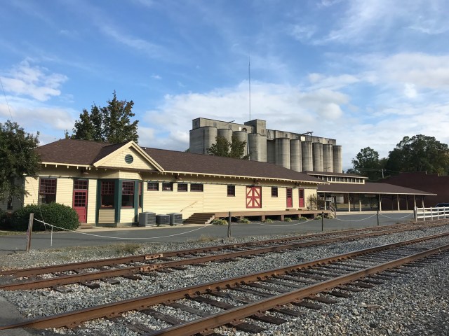
Photo: Kenneth C. Zirkel / Wikimedia Commons, CC BY-SA 4.0
Key facts
| Formed | 1841, from the portion of Montgomery County west of the Pee Dee River |
|---|---|
| Named for | John Stanly (1774–1834) of New Bern, state legislator and two-term U.S. Representative |
| County seat | Albemarle (incorporated 1857), also the largest municipality |
| Official motto | “Water, Air, Land, Success” |
| Total area | 404.81 sq mi (1,048.5 km²) |
| Land / water | 395.08 sq mi land; 9.73 sq mi water (2.40%) |
| Signature summit | Morrow Mountain, 936 ft (285 m), in Morrow Mountain State Park |
| Population | 62,504 (2020 Census); 68,830 (July 1, 2025 estimate) |
| Metro status | Albemarle Micropolitan Statistical Area; part of the Charlotte–Concord, NC-SC Combined Statistical Area |
| Region | Southern Piedmont; Yadkin–Pee Dee river basin; member of the Centralina regional council of governments |
| Time zone | Eastern (UTC−5; UTC−4 during daylight saving time) |
| Congressional district | North Carolina’s 8th (entire county) |
| FIPS code | 37167 |
| Government website | stanlycountync.gov |
Formation and name
Before 1841, the land that is now Stanly County passed through a long chain of colonial and state jurisdictions. It began as part of New Hanover Precinct; Bladen Precinct was split off in 1734; Anson County was cut from Bladen in 1750; and Montgomery County was created from Anson in 1779. In 1841 the General Assembly divided Montgomery along the Pee Dee River, and the western portion became Stanly County.
The name honors John Stanly, a Federalist from New Bern who served repeatedly in the state House of Commons and twice in Congress (1801–1803 and 1809–1811). He is best remembered for mortally wounding former governor Richard Dobbs Spaight in an 1802 duel. Local researcher Chris Bramlett has argued that Stanly had no personal tie to the area and that the name was chosen to please legislators. Because the county was so often written “Stanley,” the General Assembly formally confirmed the “Stanly” spelling in 1971.
Albemarle, laid out after the county was formed (its first courthouse went up in 1842), was incorporated in 1857 and takes its name from George Monck, first Duke of Albemarle, one of the Lords Proprietors of Carolina.
Location and boundaries
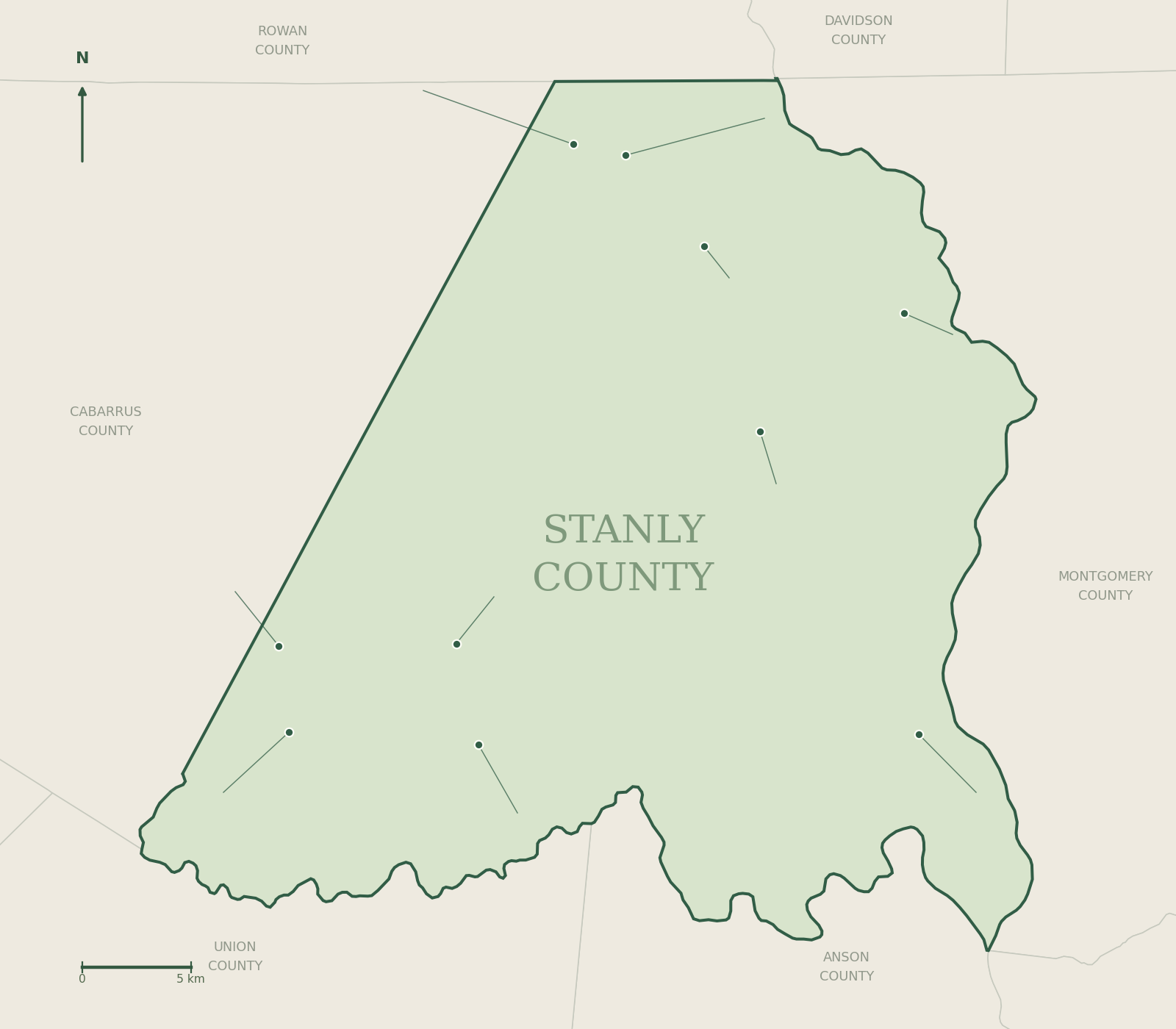
Stanly County lies in the southern Piedmont of North Carolina, roughly 40 miles east of Charlotte. Water forms much of its edge: the Yadkin and Pee Dee rivers (and the reservoirs on them) along the east, and the Rocky River along the south, joining the Pee Dee near Norwood.
| Direction | Neighboring county | Boundary notes |
|---|---|---|
| North | Rowan County | Overland boundary north of Richfield and Misenheimer |
| Northeast | Davidson County | Across the Yadkin River and its reservoirs |
| East | Montgomery County | Across Badin Lake, Falls Reservoir, Lake Tillery and the Pee Dee |
| Southeast | Richmond County | Across the Pee Dee River |
| South | Anson County | Across the Rocky River |
| South | Union County | Southwestern edge |
| West | Cabarrus County | Overland; the city of Locust extends across the line |
Adjacency per Wikipedia and NCpedia; boundary notes are general descriptions, not survey lines. Use Stanly County GIS for parcel-level questions.
ZIP codes, area codes and identifiers
| ZIP code | Post office / primary community |
|---|---|
| 28001 | Albemarle (street addresses) |
| 28002 | Albemarle (P.O. boxes, including the courthouse) |
| 28009 | Badin |
| 28097 | Locust |
| 28109 | Misenheimer |
| 28127 | New London |
| 28128 | Norwood |
| 28129 | Oakboro (also Big Lick) |
| 28137 | Richfield |
| 28163 | Stanfield |
ZIP code boundaries do not follow town or county lines, so a mailing address is not proof of which town a property sits in. The county is in the 704 telephone area code, overlaid by 980, so ten-digit dialing applies. Other identifiers: FIPS and Census GEOID 37167.
Population, 1850–2020
Every federal census since Stanly’s first. The county has never recorded a decline.
Population by decennial census
U.S. Census Bureau counts, 1850–2020
Source: U.S. Census Bureau decennial censuses, as compiled by Wikipedia from Census publications.
| Census | Population | Change | Around this time |
|---|---|---|---|
| 1850 | 6,922 | — | First census after formation |
| 1860 | 7,801 | +12.7% | Big Lick has a post office; Parker gold mine opens near Bilesville (1859) |
| 1870 | 8,315 | +6.6% | Post–Civil War years |
| 1880 | 10,505 | +26.3% | Norwood incorporates (1881) |
| 1890 | 12,136 | +15.5% | Yadkin Railroad arrives (1891); New London incorporates (1891) |
| 1900 | 15,220 | +25.4% | Efird (1896) and Wiscassett (1898) mills open in Albemarle |
| 1910 | 19,909 | +30.8% | Winston-Salem Southbound completed (1910) |
| 1920 | 27,429 | +37.8% | Largest jump on record; Badin and Narrows Dam built 1912–1917 |
| 1930 | 30,216 | +10.2% | Tillery Dam completed (1928) |
| 1940 | 32,834 | +8.7% | Morrow Mountain State Park opens (1939) |
| 1950 | 37,130 | +13.1% | Albemarle’s count jumps from 4,060 to 11,798 |
| 1960 | 40,873 | +10.1% | |
| 1970 | 42,822 | +4.8% | Stanly Community College founded (1971) |
| 1980 | 48,517 | +13.3% | Locust passes 1,500 residents |
| 1990 | 51,765 | +6.7% | |
| 2000 | 58,100 | +12.2% | Wiscassett closes its last Albemarle plant (2000) |
| 2010 | 60,585 | +4.3% | Badin smelting suspended (2002); electrode plant closed (2007) |
| 2020 | 62,504 | +3.2% | Locust grows by more than half since 2010 |
| 2025 (est.) | 68,830 | +10.1% | Estimate, not a census count |
Sources: Census counts via Wikipedia’s historical population table (citing Census Bureau publications); 2025 estimate from Census Bureau Vintage 2025 county totals. The right-hand column points to events documented elsewhere in this almanac; it does not claim to explain the change.
Race and ethnicity (2020 Census)
Hispanic or Latino residents of any race are counted separately; the other groups are non-Hispanic.
Stanly County by race and Hispanic origin, 2020
Share of 62,504 residents
Source: 2020 Census Redistricting Data (P.L. 94-171), table P2.
| Group (2020) | Residents | Share |
|---|---|---|
| White alone, not Hispanic | 48,645 | 77.83% |
| Black or African American alone, not Hispanic | 7,000 | 11.20% |
| Hispanic or Latino (any race) | 3,086 | 4.94% |
| Two or more races, not Hispanic | 2,283 | 3.65% |
| Asian alone, not Hispanic | 1,140 | 1.82% |
| American Indian or Alaska Native alone, not Hispanic | 210 | 0.34% |
| Some other race alone, not Hispanic | 131 | 0.21% |
| Native Hawaiian or Pacific Islander alone, not Hispanic | 9 | 0.01% |
| Total | 62,504 | 100% |
Change since 2000
In the 2000 Census, 84.7% of residents identified as white and 2.1% as Hispanic or Latino. By 2020 the non-Hispanic white share was 77.8% and the Hispanic share 4.9%. The Census Bureau’s V2025 population estimates put the Hispanic share at 7.1%. The 2020 Census also changed how it coded write-in race responses, which the Bureau says contributed to the national rise in people reporting two or more races; compare multiracial figures across censuses with care.
Age, households and housing (2020 Census)
| Measure | 2000 Census | 2020 Census |
|---|---|---|
| Households | 22,223 | 24,742 |
| Families | 16,156 | 16,569 |
| Median age | 37 | 42.6 |
| Share under 18 | 25.0% | 21.2% |
| Share 65 and older | 14.2% | 19.7% |
| Households with children under 18 | 32.6% | 28.9% |
| Married-couple households | 58.3% | 49.5% |
| One-person households | 24.3% | 27.9% |
| One-person households, age 65+ | 10.8% | 13.4% |
| Males per 100 females | 97.4 | 98.6 |
| Housing units | 24,582 | 27,685 |
| Owner-occupied share of occupied units | — | 72.1% |
Sources: 2000 Census SF1 and 2020 Census Demographic and Housing Characteristics, as summarized in Wikipedia’s Stanly County article. The 65-and-older share rose by more than five percentage points in two decades.
Income, education and work (ACS 2020–2024)
American Community Survey five-year estimates compared with North Carolina. Sampling error applies; treat small differences cautiously.
| Indicator | Stanly County | North Carolina |
|---|---|---|
| Median household income (2024 dollars) | $60,704 | $72,388 |
| Per capita income (2024 dollars) | $31,661 | $41,385 |
| Persons in poverty | 12.6% | 12.5% |
| High school graduate or higher (25+) | 88.5% | 90.1% |
| Bachelor’s degree or higher (25+) | 19.9% | 35.7% |
| Owner-occupied housing rate | 74.5% | 66.6% |
| Median value, owner-occupied home | $242,400 | $288,900 |
| Median gross rent | $861 | $1,228 |
| Mean commute (minutes) | 28.1 | 25.1 |
| Foreign-born residents | 4.4% | 9.1% |
| Households with broadband | 88.4% | 90.1% |
| Veterans | 3,306 | — |
Median household income, 2020–2024
In 2024 inflation-adjusted dollars
Source: U.S. Census Bureau QuickFacts (ACS 5-year estimates, 2020–2024). For comparison, the 2000 Census put the county’s median household income at $36,898 in 1999 dollars.
Towns and census places
Ten incorporated municipalities and two census-designated places (CDPs). Together they hold roughly half the county’s residents; the rest live in unincorporated areas.
2020 Census population by place
Municipalities and CDPs in Stanly County
Source: 2020 Census (P.L. 94-171). *Locust’s total includes the part of the city that extends into Cabarrus County.
| Place | Type | 2010 | 2020 | Incorporated | Guide |
|---|---|---|---|---|---|
| Albemarle | City (county seat) | 15,903 | 16,432 | 1857 | Town guide |
| Locust | City (partly in Cabarrus) | 2,930 | 4,537 | — | Town guide |
| Norwood | Town | 2,379 | 2,367 | 1881 | Town guide |
| Oakboro | Town | 1,859 | 2,128 | — (renamed Oakboro 1915) | Town guide |
| Badin | Town | 1,974 | 2,024 | — (planned village begun 1912) | Town guide |
| Stanfield | Town | 1,486 | 1,585 | — (established 1912) | Town guide |
| Red Cross | Town | 742 | 762 | 2002 | Town guide |
| Misenheimer | Village | 728 | 650 | 2003 | Town guide |
| New London | Town | 600 | 607 | 1891 | Town guide |
| Richfield | Town | 613 | 582 | — | Town guide |
| Millingport | CDP | 599 | 588 | Unincorporated | Community guide |
| Aquadale | CDP | 397 | 348 | Unincorporated | Community guide |
Sources: 2020 and 2010 Census counts via Wikipedia place articles and Census QuickFacts; CDP 2010 figures via CityPopulation.de (Census data). “—” means we could not verify an incorporation date from a primary source; confirm with the town clerk. Some tabulations show slightly different 2020 numbers for a few towns after later Census corrections; the figures here are the published 2020 Census counts.
Townships
North Carolina townships are geographic units used for tax listing, census tabulation and genealogy, not governments. Stanly County has ten.
Several township names echo communities: Big Lick (Oakboro’s predecessor settlement), Center (the camp-meeting community that grew into Norwood), Endy, and Furr (Oakboro was briefly “Furr Town”). Township lines matter most to genealogists, because older census schedules, tax lists and deeds are filed by township. Confirm exact lines with Stanly County GIS or the Register of Deeds.
Township names per the U.S. Geological Survey Geographic Names Information System (via MyTopo).